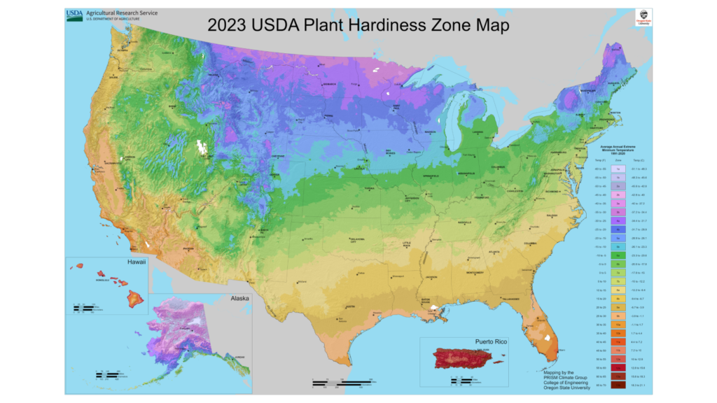
Understanding planting zones is crucial for farmers, gardeners, and horticulturists to ensure that their crops thrive in the appropriate climate. Traditionally, these zones were determined by observing local climate patterns and historical data. However, with the advent of modern technology, the accuracy and efficiency of determining planting zones have been significantly enhanced. This blog explores how technology is revolutionizing the way we identify and utilize planting zones, ensuring better crop yields and sustainable agriculture.
1. Satellite Imaging and Remote Sensing
Satellite imaging and remote sensing technologies have transformed the way we monitor and analyze the Earth’s surface. These tools provide valuable data on various environmental factors such as soil moisture, temperature, and vegetation health.
Normalized Difference Vegetation Index (NDVI): This index is derived from satellite imagery and helps in assessing the health and vigor of vegetation. Consequently, by analyzing NDVI data, farmers can identify the best planting zones based on the current health of the land.
Moreover, Landsat and Sentinel Satellites offer high-resolution images that help in monitoring changes in land cover, soil conditions, and climate over time. This data is, therefore, invaluable for understanding long-term trends and making informed decisions about planting zones.
2. Geographic Information Systems (GIS)
Geographic Information Systems (GIS) integrate various types of data to create detailed maps and models of planting zones. GIS can analyze topography, soil type, climate data, and other environmental variables to provide a comprehensive view of suitable planting areas.
Soil Mapping: GIS can create detailed soil maps that highlight different soil types and their properties. This information helps in determining the best crops for specific areas based on soil composition.
Climate Modeling: By incorporating historical climate data and future climate projections, GIS can predict how planting zones might shift due to climate change. This allows farmers to plan for long-term agricultural strategies.
3. Internet of Things (IoT) and Smart Sensors
The Internet of Things (IoT) has brought a new level of precision to agriculture. Specifically, smart sensors placed in fields collect real-time data on various environmental factors, thereby providing farmers with up-to-date information on their crops and soil conditions.
Soil Moisture Sensors: These sensors measure the moisture content of the soil, helping farmers to irrigate efficiently and prevent overwatering or underwatering. This is crucial for maintaining optimal soil conditions in planting zones.
Climate Sensors: Sensors that monitor temperature, humidity, and other climatic factors can provide real-time data that helps in understanding microclimates within a larger planting zone.
4. Big Data and Machine Learning
The integration of big data and machine learning algorithms has opened up new possibilities for analyzing and predicting planting zones. By processing vast amounts of data, these technologies can, therefore, identify patterns and make accurate predictions about the suitability of different areas for various crops.
Predictive Analytics: Machine learning models can analyze historical weather data, soil conditions, and crop yields to predict the best planting times and locations. Consequently, this helps in optimizing agricultural practices and improving crop yields.
Furthermore, Customized Recommendations: Big data analytics can provide personalized recommendations to farmers based on their specific conditions and constraints. As a result, this tailored approach ensures that each farm gets the most accurate advice for maximizing productivity.
5. Mobile Apps and Platforms
Mobile technology has, indeed, made it easier for farmers to access information about planting zones. Consequently, various apps and platforms provide real-time data, forecasts, and recommendations, thereby making advanced agricultural knowledge accessible to even small-scale farmers.
Planting Zone Maps: Mobile apps can display interactive maps that show current planting zones, allowing farmers to see which crops are best suited for their location.
Real-Time Alerts: Apps can send notifications about weather changes, pest outbreaks, and other critical information, helping farmers to respond promptly and protect their crops.
Conclusion
The integration of technology in determining planting zones has revolutionized agriculture, making it more precise, efficient, and sustainable. For instance, from satellite imaging and GIS to IoT and machine learning, advancements provide farmers with essential tools to optimize planting strategies and ensure successful harvests. Moreover, as technology evolves, we can expect even more innovative solutions to further enhance our understanding of planting zones, ultimately contributing to a more resilient and productive agricultural sector.